The Cocos (Keeling) Islands are a pair of atolls in the Indian Ocean that lie roughly 1200km/750mi southwest of Jakarta. In 2016 I traveled to South Keeling, the larger of the two atolls, as part of my research on Charles Darwin’s theory of coral reef formation. South Keeling has a short but remarkable social and political history. At the time of the Beagle‘s visit, the atoll had only been inhabited for about a decade.

Darwin and his shipmates spent twelve days at South Keeling during the final year of their 1831-1836 voyage around the world. It was the first atoll they had visited, and he eagerly explored it on foot while the Beagle‘s officers and crew carried out the hydrographic survey that would yield a new chart of the atoll.
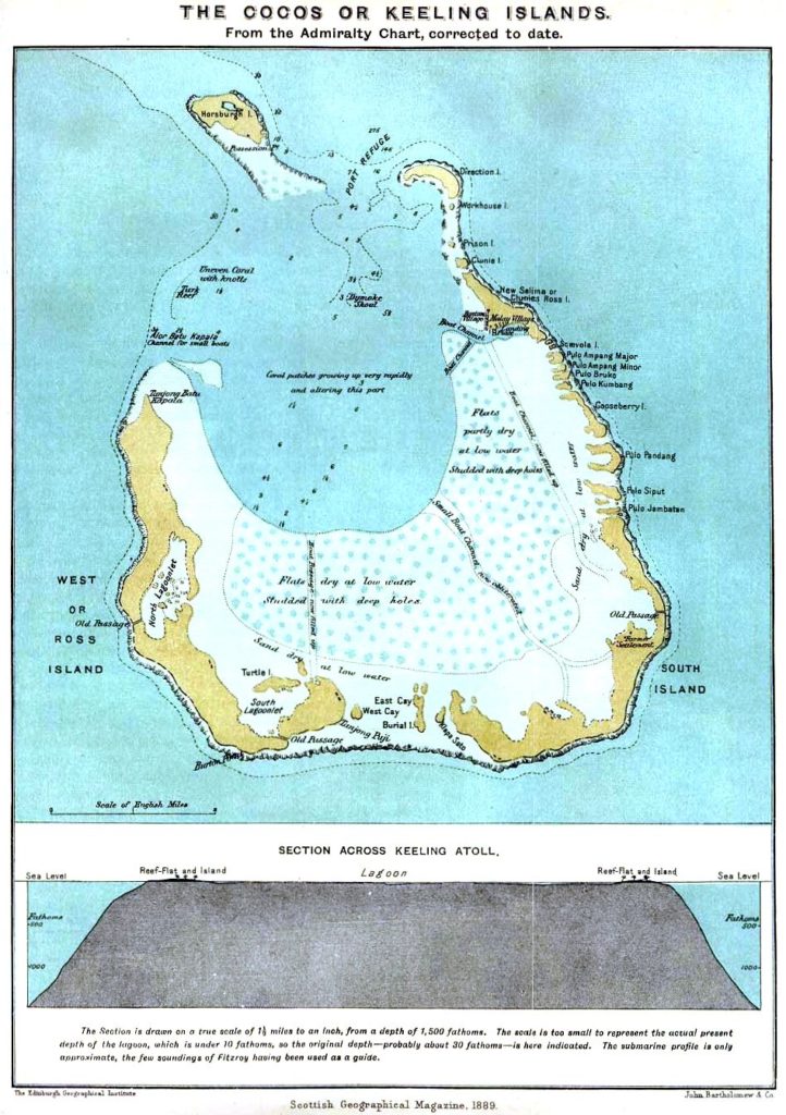
By the time the Beagle reached South Keeling on 2 April 1836, Darwin had already come up with a theory of coral reef formation to explain the origin of atolls like South Keeling (as well as barrier reefs like the one he had seen at Tahiti). Therefore, in addition to pursuing general information about the atoll’s geology, flora, and fauna, he was eager to make observations relevant to evaluating his new theory. I discuss his fieldwork at South Keeling in my article “An Amphibious Being” and in chapter five of Darwin’s Evolving Identity, and my transcription of Darwin’s field notes from South Keeling has been published online here.

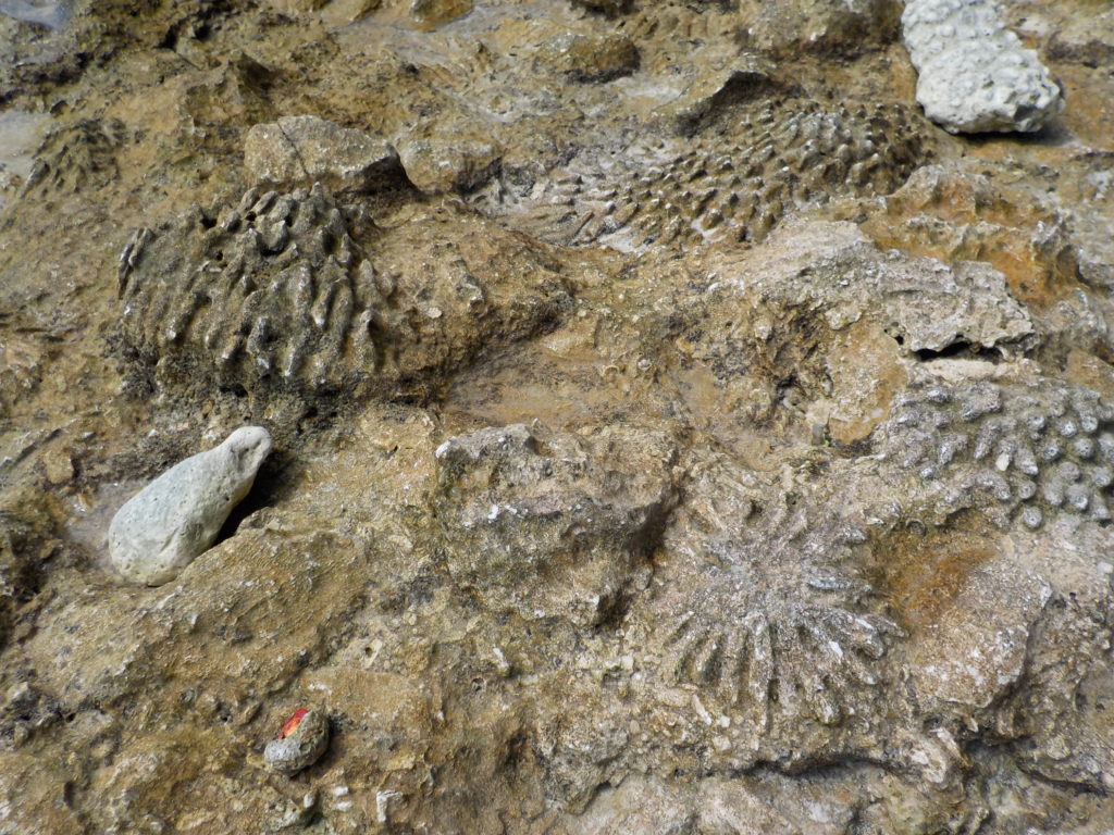
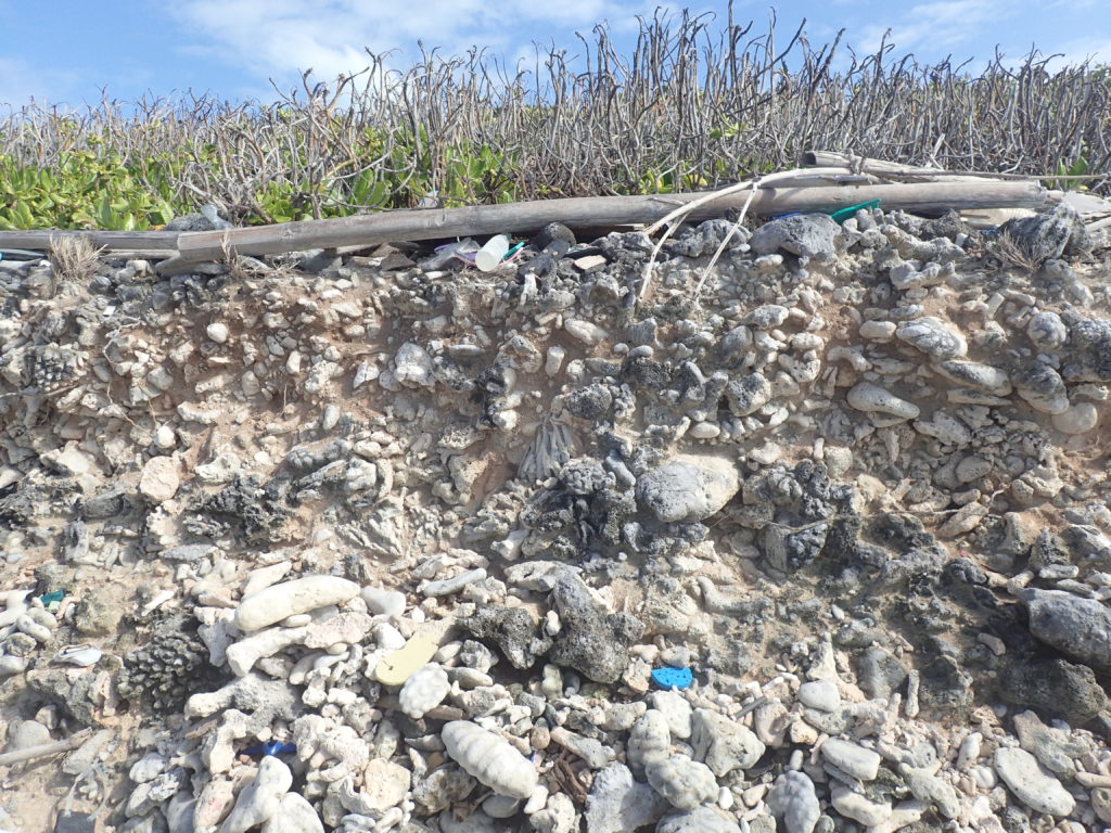
In visits to several of South Keeling’s islets, Darwin collected dozens of specimens of living, recently dead, and fossil coral. He was eager to document how living corals were aggregated into the solid structure of a reef. I saw examples of these various forms myself.
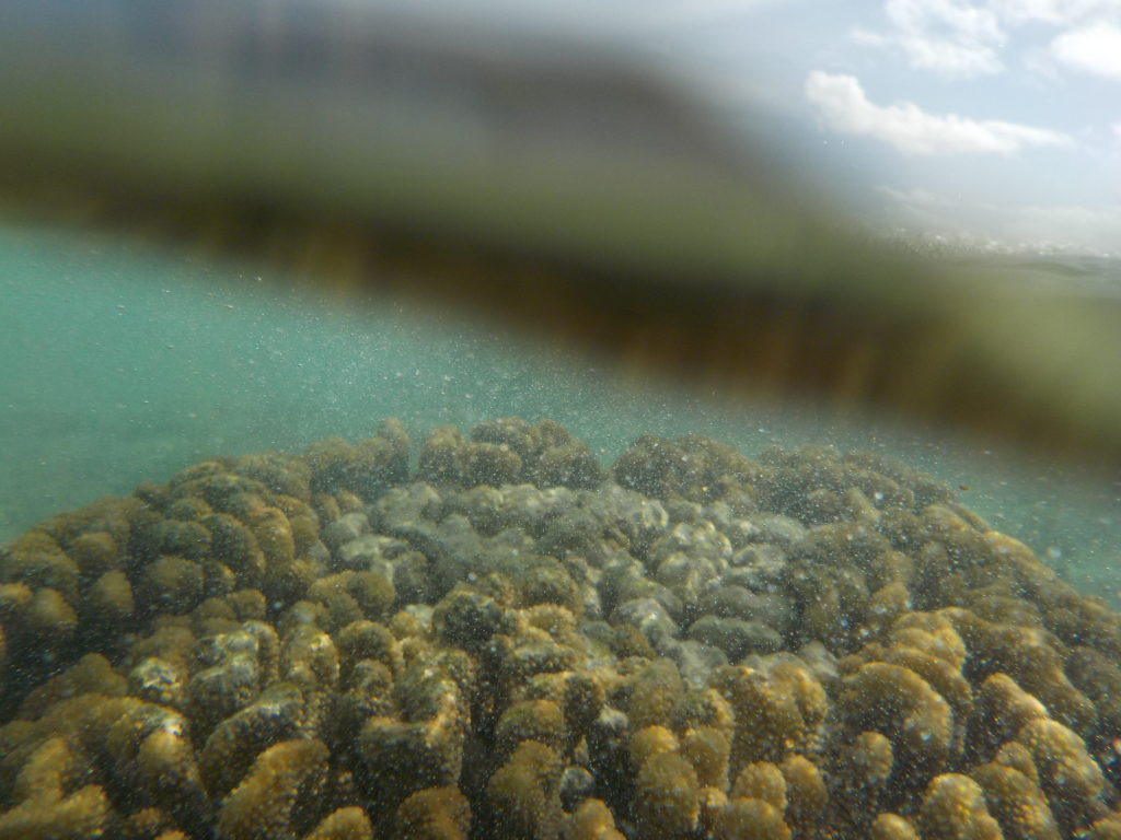
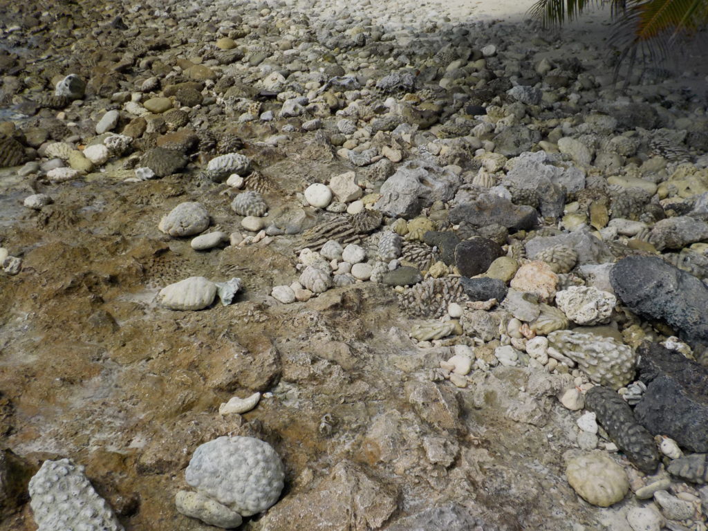
Darwin was fascinated by the thought that coral-eating parrot fish might grind and excrete coral into fine sand, and he felt certain that calcareous algae played an important role in binding sediments to the reef.
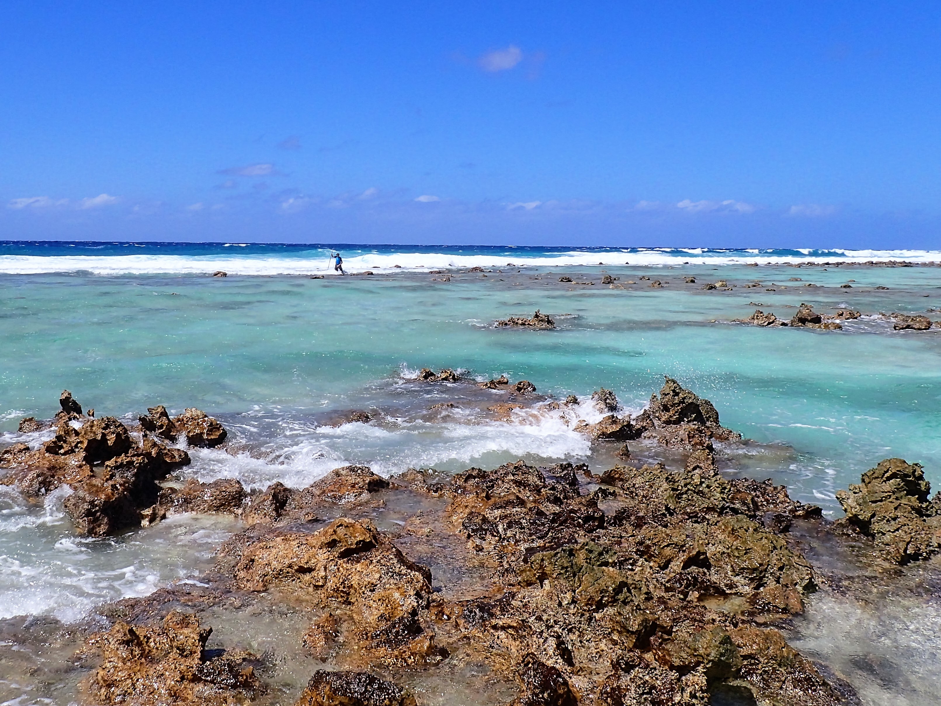
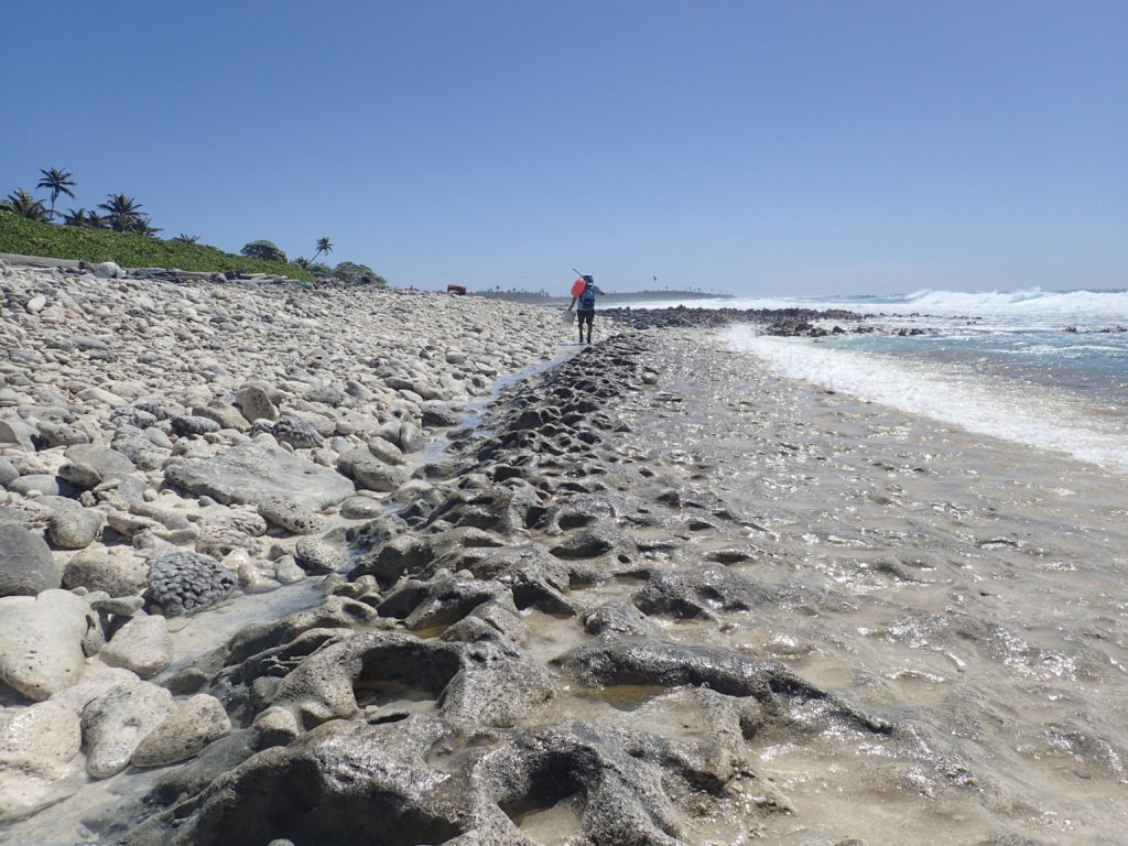
Darwin also described walking systematically across the short axis of the narrow islets, from the lagoon’s calm waters toward the ocean, in the fashion of what later came to be called an ecological transect. Then he waded out beyond the beach, across dead and living corals to where the waves broke over the face of the reef. He desperately wanted to see what kinds of corals were capable of resisting the relentless force of the ocean, the ones building the “bulwark” of the reef. He believed they must be different genera from those that flourished in the calmer, but murkier, waters of the lagoon.
In his notes, Darwin wrote of wading toward the reef’s outer margin, which, he said, “I was able to reach by the aid of a leaping-pole, and over which the sea broke with some violence.” At this moment he would have been standing in among the crashing waves that outline atolls and barrier reefs so vividly when viewed from above. Describing such a view from the mountains of Tahiti, he had called it the “line of brilliant white where the waves first encountered the wall of coral.” Now, with the aid of his “leaping-pole,” he was balanced atop just such a wall.
I think everyone who has read Darwin’s brief mention of the leaping-pole must have tried to imagine the scene in their mind’s eye. There is, of course, no extant picture of Darwin leaping. But there are other nineteenth-century images of “pole leaping,” for it was a method commonly used by ramblers to cross ditches and streams.
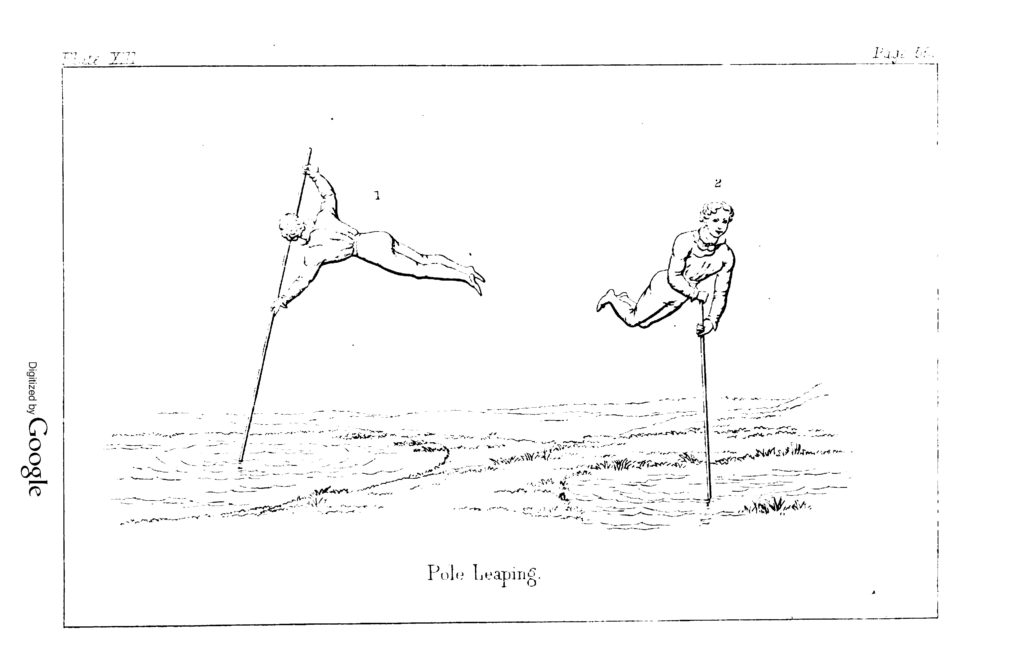
This picture seems to suggest that Darwin might have soared out into the waves and landed nimbly atop growing corals. Is that a preposterous idea? Far from being the sickly invalid he became in later years, Darwin was notably athletic and adventurous in his youth. I wanted to try wading in Darwin’s footsteps, leaping-pole in hand, to see what it would be like to stand atop the bulwark of the South Keeling reef.
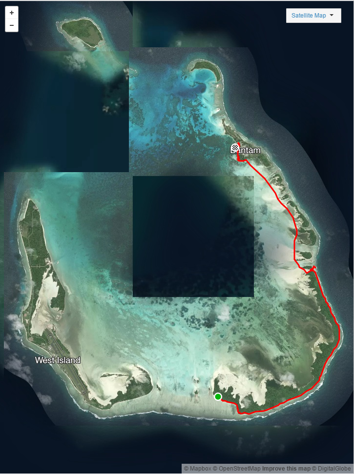
When I arrived at Cocos I rented a bicycle to help me get around the islet where I’d be staying, and I soon learned of Kylie and Ash James, who run a guide service. The next morning Ash took me out from West Island in a motorized kayak to see the lagoon and some other islets. As I described my interest in Darwin’s time at South Keeling, I mentioned something that had long puzzled me. Since Darwin did not, to my knowledge, record that he’d used a leaping-pole anywhere else during the Beagle voyage, it seemed possible that he had procured (or fashioned) one there. But South Keeling has no native plant that would yield an appropriately strong and slender pole. Had he been traveling with one the whole time without mentioning it?
Ash quickly replied that there was an obvious solution: bamboo may not grow at Cocos, but it regularly washes up on the windward side of the atoll. We kayaked across the corner of the lagoon to South Island, clambered over the modest sandy dunes that constitute Cocos’ highest terrain, and beheld the coastline where wind and waves bring flotsam directly from Southeast Asia.
The following day, I met up early in the morning with Ash to do a long walk from the southern tip of the atoll along a series of islets and across several channels to the settlement on Home Island in the northeast. We timed the walk so that we would encounter the channels between islets while the tide was low.
I was fascinated to see the reef in various stages of
In the late morning we reached a place where waves were pounding the reef crest at the outer margin of a broad coral flat. Ash took some photos while I waded across the reef flat and tried to duplicate Darwin’s experience of using a leaping pole to examine how the bulwark species grew on the face of the reef.